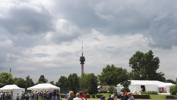
Park nearby Út a Kerthez
Hungary
Park nearby Út a Kerthez
Út a Kerthez
6, Gém utca, 1107, Budapest, HU Hungary
contacts phone
:
+36 20 512 0206
website:
utakerthez.hu
Latitude:
47.4701293
, Longitude:
19.1201526
larger map & directions
read more
nearest Park
277 m
Kutyafuttató - Pöttyös
Budapest, Üllői út 173
Park
read more
589 m
Babák rózsaparkja - József Attila lakótelep
Budapest, Dési Huber utca 22
Park
read more
648 m
Nyúldomb
IX. kerület
Park
read more
674 m
Valéria tér - park
Budapest
Park
read more
684 m
Nagyjátszó
IX. kerület
Park
read more
692 m
Nagyjátszótér - Csigapark
Dési Huber utca Napfény utca Csengettyű utca
Park
read more
699 m
Nyúldomb
Budapest, Dési Huber utca 32
Park
read more
710 m
Blériot Emlékmű
Budapest, Dési Huber utca 12
Park
read more
728 m
Közlekedési park
Budapest, József Attila-lakótelep
Park
read more
859 m
Richter Gedeon Részvénytársaság Pihenő park
Budapest
Park
read more
1.319 km
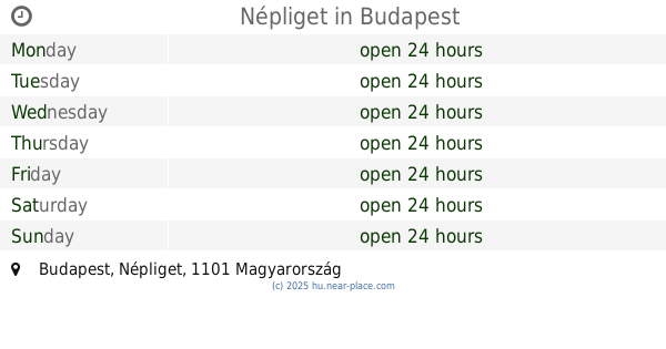
Népliget
Budapest, Népliget
Park
read more
1.319 km
Népliget
Budapest, People's Park
Park
read more
1.674 km
Kós Károly tér
Budapest, Kós Károly tér
Park
read more
1.823 km
Csajkovszkij park
Budapest, Halom utca
Park
read more
1.97 km
Lechner Ödön szobor
Budapest
Park
read more
2.027 km
Közösségi kert
Budapest, Dobó Katica utca
Park
read more
2.043 km
Magyar Oltár
Budapest
Park
read more
2.105 km
KRESZ park
Budapest, Kőér utca 27
Park
read more
2.106 km
Rezső tér
Budapest
Park
read more
2.106 km
Szenes Iván tér
Budapest
Park
read more
2.132 km
Óhegy park
Budapest, Óhegy utca
Park
read more
2.175 km
Rottenbiller park
Budapest, Rottenbiller park
Park
read more
2.358 km
Rusz-Bazsant park
Budapest, Ady Endre út 114
Park
read more
2.549 km
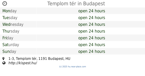
Templom tér
Budapest, Templom tér 1-3
Park
read more
2.549 km
temple Square
Budapest, Templom tér 1-3
Park
read more
📑
all categories
Accounting
Administrative area level 1
Administrative area level 2
Airport
Amusement park
Aquarium
Art gallery
Atm
Bakery
Bank
Bar
Beauty salon
Bicycle store
Book store
Bowling alley
Bus station
Cafe
Campground
Car dealer
Car rental
Car repair
Car wash
Casino
Cemetery
Church
City hall
Clothing store
Colloquial area
Convenience store
Country
Courthouse
Dentist
Department store
Doctor
Electrician
Electronics store
Embassy
Finance
Fire station
Florist
Food
Funeral home
Furniture store
Gas station
General contractor
Grocery or supermarket
Gym
Hair care
Hardware store
Health
Hindu Temple
Home goods store
Hospital
Insurance agency
Intersection
Jewelry store
Laundry
Lawyer
Library
Light rail station
Liquor store
Local government office
Locality
Locksmith
Lodging
Meal delivery
Meal takeaway
Mosque
Movie rental
Movie theater
Moving company
Museum
Natural feature
Neighborhood
Night club
Painter
Park
Parking
Pet store
Pharmacy
Physiotherapist
Place of worship
Plumber
Point of interest
Police
Political
Post office
Premise
Real estate agency
Restaurant
Roofing contractor
Route
Rv park, camping
School
Shoe store
Shopping mall
Spa
Stadium
Storage
Store
Subpremise
Subway station
Supermarket
Synagogue
Taxi stand
Train station
Transit station
Travel agency
University
Veterinary care
Zoo
administrative area level 3
sublocality level 1
↑