Park nearby Tinódi park
Hungary
Park nearby Tinódi park
Tinódi park
14, Tinódi utca, 1095, Budapest, HU Hungary
contacts phone
:
+36
Latitude:
47.4795506
, Longitude:
19.0703543
larger map & directions
read more
nearest Park
292 m
Ferenc tér
Budapest, Ferenc tér 1
Park
read more
406 m
SPECIÁLGÉP
Budapest, Thaly Kálmán utca 20
Park
read more
473 m
1956 Emlékmű
Budapest, Bakáts tér 4
Park
read more
496 m
Bakáts Square
Budapeszt
Park
read more
496 m
Bakáts tér
Budapest
Park
read more
496 m
Bakáts Square
Budapest
Park
read more
506 m
Tűzliliom Park
IX. kerület
Park
read more
525 m
Nehru coast
Budapest, Nehru part
Park
read more
550 m
Salkaházi Sára park
IX. kerület
Park
read more
739 m
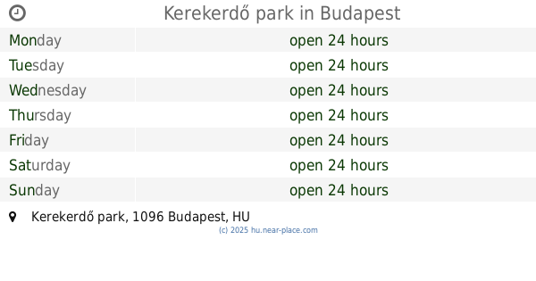
Kerekerdő park
Budapest, Kerekerdő park
Park
read more
748 m
Kerekerdő park
Budapest
Park
read more
748 m
Kerekerdő park
Budapeszt
Park
read more
796 m
Bajor Gizi park
Budapest, Bajor Gizi park 1
Park
read more
805 m
Goldmann György tér
Budapest
Park
read more
805 m
Goldmann György tér
Budapeszt
Park
read more
821 m
IX Kerület Kutyafuttatö
Budapest, Mester utca 67
Park
read more
827 m
Markusovszky tér
Budapeszt
Park
read more
832 m
Kutyafuttató - Markusovszky tér
Budapest, Markusovszky tér
Park
read more
850 m
Egyetemisták parkja
Budapest
Park
read more
873 m
Kertvilágítás Kft.
Budapest, Soroksári út 48
Park
read more
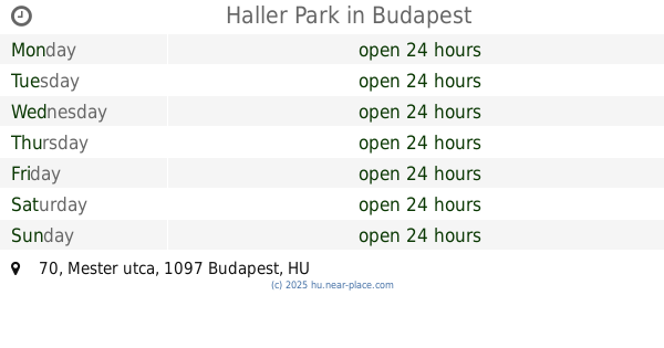
883 m
Haller Park
Budapest, Mester utca 70
Park
read more
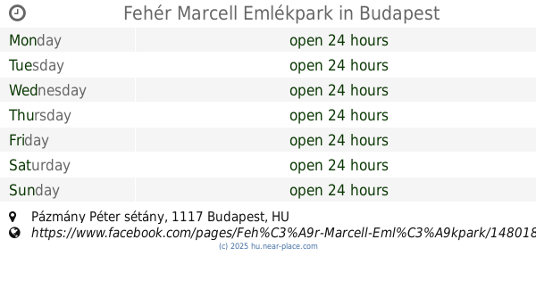
967 m
Fehér Marcell Emlékpark
Budapest, Fehér Marcell Emlékpark, Pázmány Péter sétány
Park
read more
967 m
Fehér Marcell Emlékpark
XI. kerület
Park
read more
1.125 km
Park
Budapest, Molnár Ferenc tér
Park
read more
1.273 km
Práter park
Budapest, Práter utca 58
Park
read more
📑
all categories
Accounting
Administrative area level 1
Administrative area level 2
Airport
Amusement park
Aquarium
Art gallery
Atm
Bakery
Bank
Bar
Beauty salon
Bicycle store
Book store
Bowling alley
Bus station
Cafe
Campground
Car dealer
Car rental
Car repair
Car wash
Casino
Cemetery
Church
City hall
Clothing store
Colloquial area
Convenience store
Country
Courthouse
Dentist
Department store
Doctor
Electrician
Electronics store
Embassy
Finance
Fire station
Florist
Food
Funeral home
Furniture store
Gas station
General contractor
Grocery or supermarket
Gym
Hair care
Hardware store
Health
Hindu Temple
Home goods store
Hospital
Insurance agency
Intersection
Jewelry store
Laundry
Lawyer
Library
Light rail station
Liquor store
Local government office
Locality
Locksmith
Lodging
Meal delivery
Meal takeaway
Mosque
Movie rental
Movie theater
Moving company
Museum
Natural feature
Neighborhood
Night club
Painter
Park
Parking
Pet store
Pharmacy
Physiotherapist
Place of worship
Plumber
Point of interest
Police
Political
Post office
Premise
Real estate agency
Restaurant
Roofing contractor
Route
Rv park, camping
School
Shoe store
Shopping mall
Spa
Stadium
Storage
Store
Subpremise
Subway station
Supermarket
Synagogue
Taxi stand
Train station
Transit station
Travel agency
University
Veterinary care
Zoo
administrative area level 3
sublocality level 1
↑