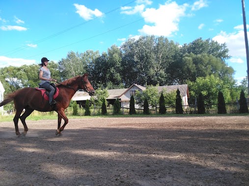
Park nearby Szonja lovas tanya
Coronavirus disease (COVID-19) Situation
confirmed cases
2230232
deaths
49048
Hungary
Park nearby Szonja lovas tanya
Szonja lovas tanya
1, 4302, 6771, Szeged, HU Magyarország
contacts phone
:
+36
Latitude:
46.2014458
, Longitude:
20.1967989
larger map & directions
read more
nearest Park
1.489 km
Monti Sándor Park
Szeged, Ikon sor 12
Park
read more
3.96 km
Gulácsi Park
Szeged
Park
read more
4.314 km
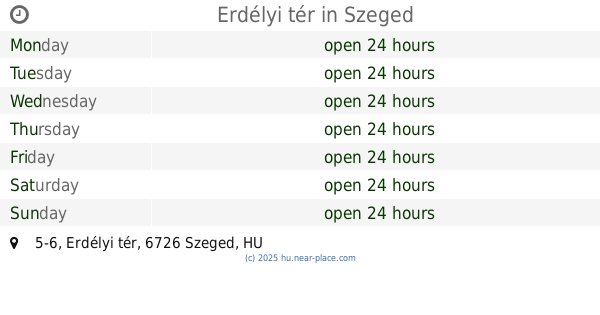
Erdélyi tér
Szeged, Erdélyi tér 5-6
Park
read more
4.627 km
Szegedi Füvészkert
Szeged, Lövölde út 42
Park
read more
4.627 km
Szeged Botanic Garden
Szeged, Lövölde út 42
Park
read more
4.887 km
Deszki focipálya
Deszk
Park
read more
4.917 km
Mélypont Emlékhely
Tiszasziget
Park
read more
5.069 km
Szegedi focipálya
Szeged
Park
read more
5.702 km
Károly Híd
Szeged
Park
read more
5.828 km
Erzsébet Liget
Szeged, Népkert sor
Park
read more
5.889 km
SZTE-JGYTF Testnevelési és Sporttudományi Intézet
Szeged
Park
read more
5.967 km
Vasúti híd emlékmű
Szeged, Korányi fasor 19
Park
read more
6.403 km
Mátyás király tér
Szeged, Mátyás király tér 7b
Park
read more
6.555 km
Roosevelt tér
Szeged, Dugonics tér 2
Park
read more
6.779 km
Városi stadion
Szeged, 6723, Felső Tisza-Part 1-3
Park
read more
6.886 km
Szechenyi Square
Szeged, Széchenyi tér 3
Park
read more
6.889 km
Disznófejű fa
Szeged, Széchenyi tér 3
Park
read more
7.158 km
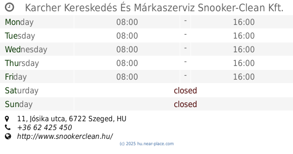
Karcher Kereskedés És Márkaszerviz Snooker-Clean Kft.
Szeged, Jósika utca 11
Park
read more
7.379 km
KÖLYÖKPARK
Szeged, Londoni körút 3
Park
read more
7.651 km
Klapka tér
Segedyn
Park
read more
8.09 km
HQ Partner Kft.
Szeged, Kálvária sugárút 65-67
Park
read more
8.294 km
G4S
Szeged, József Attila sugárút 115
Park
read more
8.551 km
Franciahögy
Szeged, Tópart utca 6
Park
read more
8.957 km
Szeged Vértó Nemzeti Emlékhely
Szeged, Csongrádi sugárút 114
Park
read more
9.813 km
Postás pálya
Szeged
Park
read more
📑
all categories
Accounting
Administrative area level 1
Administrative area level 2
Airport
Amusement park
Aquarium
Art gallery
Atm
Bakery
Bank
Bar
Beauty salon
Bicycle store
Book store
Bowling alley
Bus station
Cafe
Campground
Car dealer
Car rental
Car repair
Car wash
Casino
Cemetery
Church
City hall
Clothing store
Colloquial area
Convenience store
Country
Courthouse
Dentist
Department store
Doctor
Electrician
Electronics store
Embassy
Finance
Fire station
Florist
Food
Funeral home
Furniture store
Gas station
General contractor
Grocery or supermarket
Gym
Hair care
Hardware store
Health
Hindu Temple
Home goods store
Hospital
Insurance agency
Intersection
Jewelry store
Laundry
Lawyer
Library
Light rail station
Liquor store
Local government office
Locality
Locksmith
Lodging
Meal delivery
Meal takeaway
Mosque
Movie rental
Movie theater
Moving company
Museum
Natural feature
Neighborhood
Night club
Painter
Park
Parking
Pet store
Pharmacy
Physiotherapist
Place of worship
Plumber
Point of interest
Police
Political
Post office
Premise
Real estate agency
Restaurant
Roofing contractor
Route
Rv park, camping
School
Shoe store
Shopping mall
Spa
Stadium
Storage
Store
Subpremise
Subway station
Supermarket
Synagogue
Taxi stand
Train station
Transit station
Travel agency
University
Veterinary care
Zoo
administrative area level 3
sublocality level 1
↑