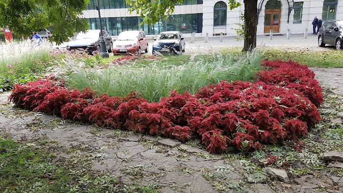
Park nearby Döbrentei tér
Coronavirus disease (COVID-19) Situation
confirmed cases
2230232
deaths
49048
Hungary
Park nearby Döbrentei tér
Döbrentei tér
Budapest, Attila út, 1016 Magyarország
contacts phone
:
+36
Latitude:
47.4905978
, Longitude:
19.0461179
larger map & directions
read more
nearest Park
143 m
Szerb Ortodox Székesegyház Emlékmű
Budapest, Döbrentei utca 22
Park
read more
178 m
Eszperantó park, Zamenhof statue
Budapest
Park
read more
195 m
Esperanto Parko
Budapest
Park
read more
281 m
Gellérthegy Természetvédelmi terület
Budapest, Gellért-hegy
Park
read more
281 m
Gellért Hill
Budapest, Gellért-hegy
Park
read more
433 m
Gellérthegy
Hungary
Park
read more
525 m
Filozófusok kertje
Budapest, Tabán
Park
read more
547 m
Citadella virágos kert
Budapest
Park
read more
573 m
Gellérthegy Jubileumi park
Budapest, Verejték utca 2
Park
read more
604 m
Vigadó tér
Budapest, Vigadó tér 2
Park
read more
810 m
Mátyás-kút
Budapest, Szent György utca
Park
read more
886 m
József Nádor tér
Budapest
Park
read more
958 m
Park
Krisztinaváros
Park
read more
974 m
Erzsébet téri park
Budapest, Erzsébet tér 4
Park
read more
978 m
Pop Up Park
Budapest, Bárczy István utca 7473
Park
read more
981 m
Erzsébet Square
Budapest, Deák Ferenc tér 2
Park
read more
981 m
Skwer Erzsébet
Budapest, Deák Ferenc tér 2
Park
read more
981 m
Erzsébet tér
Budapest, Deák Ferenc tér 2
Park
read more
986 m
Danubius Fountain
Budapest, Erzsébet tér 4
Park
read more
986 m
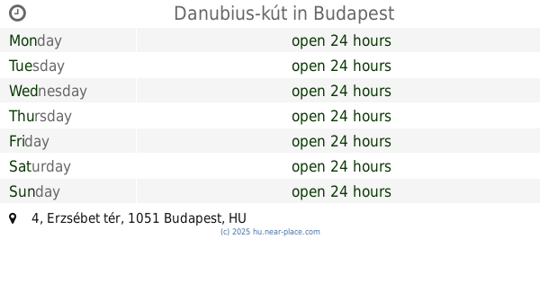
Danubius-kút
Budapest, Erzsébet tér 4
Park
read more
1.001 km
Széchenyi tér
Budapest, Széchenyi István tér
Park
read more
1.012 km
Horváth Kert
Budapest, Krisztina körút 93
Park
read more
1.1 km
Madách Tér
Budapest, Madách Imre tér 7
Park
read more
1.162 km
The Starting Point of 1956 Revolution
Budapest, Budafoki út 4
Park
read more
1.213 km
Logodi utcai Park
Krisztinaváros
Park
read more
📑
all categories
Accounting
Administrative area level 1
Administrative area level 2
Airport
Amusement park
Aquarium
Art gallery
Atm
Bakery
Bank
Bar
Beauty salon
Bicycle store
Book store
Bowling alley
Bus station
Cafe
Campground
Car dealer
Car rental
Car repair
Car wash
Casino
Cemetery
Church
City hall
Clothing store
Colloquial area
Convenience store
Country
Courthouse
Dentist
Department store
Doctor
Electrician
Electronics store
Embassy
Finance
Fire station
Florist
Food
Funeral home
Furniture store
Gas station
General contractor
Grocery or supermarket
Gym
Hair care
Hardware store
Health
Hindu Temple
Home goods store
Hospital
Insurance agency
Intersection
Jewelry store
Laundry
Lawyer
Library
Light rail station
Liquor store
Local government office
Locality
Locksmith
Lodging
Meal delivery
Meal takeaway
Mosque
Movie rental
Movie theater
Moving company
Museum
Natural feature
Neighborhood
Night club
Painter
Park
Parking
Pet store
Pharmacy
Physiotherapist
Place of worship
Plumber
Point of interest
Police
Political
Post office
Premise
Real estate agency
Restaurant
Roofing contractor
Route
Rv park, camping
School
Shoe store
Shopping mall
Spa
Stadium
Storage
Store
Subpremise
Subway station
Supermarket
Synagogue
Taxi stand
Train station
Transit station
Travel agency
University
Veterinary care
Zoo
administrative area level 3
sublocality level 1
↑