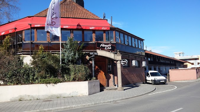
Night club nearby Eger Exit
Coronavirus disease (COVID-19) Situation
confirmed cases
2230232
deaths
49048
Hungary
Night club nearby Eger Exit
Eger Exit
Eger, 3300, Vörösmarty Mihály utca 25-27 Magyarország
contacts phone
:
+36
Latitude:
47.897605
, Longitude:
20.367564
read more
nearest Night club
527 m
Játszótér
Eger, Bem tábornok tér 1
Night club
read more
645 m
Exithouse
Eger, Csiky Sándor utca 7/A
Night club
read more
654 m
Lillian massage parlor
Eger, Deák Ferenc utca 19
Night club
read more
654 m
Lilliom Masszázs szalon
Eger, Deák Ferenc utca 19
Night club
read more
656 m
Leonardo Dance Bar
Eger, Klapka György utca 8
Night club
read more
716 m
RageRoom
Eger, Széchenyi István utca 14
Night club
read more
767 m
Bíboros
Eger, Bajcsy-Zsilinszky Endre 6
Night club
read more
851 m
Liget Dance Hall
Eger, Érsekkert 1
Night club
read more
856 m
Hippolit Club
Eger, Katona István tér 2
Night club
read more
877 m
Eger Árva Köz
Eger, Dobó István tér 4
Night club
read more
902 m
OrangeSegway
Eger, Dobó István tér
Night club
read more
1.038 km
Gólya Utcai Játszótér
Eger
Night club
read more
1.093 km
Márai Aktív Turisztikai Látogatóközpont
Eger, Szépasszonyvölgy 35
Night club
read more
1.576 km
Rock Cafe
Eger, Sas utca 6
Night club
read more
2.341 km
Ilcsi Naturkozmetika
Eger, Cifrakapu utca 128
Night club
read more
3.207 km
Roli Pincészet
Eger, Tihamérszereda
Night club
read more
5.147 km
Frankó Presszó
Egerszalók, Széchenyi István út 75
Night club
read more
7.023 km
Fűzfa vendégház
Demjén
Night club
read more
8.08 km
Giga Ugrálóváras Játszópark
Demjén, Dózsa György utca 68
Night club
read more
8.528 km
Egerbaktai Bányató
Egerbakta
Night club
read more
9.058 km
Síkfőkúti tó
Noszvaj
Night club
read more
10.088 km
Faluház
Felsőtárkány, Fő út 350
Night club
read more
11.896 km
Demjén Termáltó
Kerecsend, Füzesabonyi út
Night club
read more
16.262 km
ÉRTÉKŐRZÉS
Mezőkövesd, Olajfa út 1
Night club
read more
17.951 km
Movie Club
Mezőkövesd, Mátyás király út 105
Night club
read more
📑
all categories
Accounting
Administrative area level 1
Administrative area level 2
Airport
Amusement park
Aquarium
Art gallery
Atm
Bakery
Bank
Bar
Beauty salon
Bicycle store
Book store
Bowling alley
Bus station
Cafe
Campground
Car dealer
Car rental
Car repair
Car wash
Casino
Cemetery
Church
City hall
Clothing store
Colloquial area
Convenience store
Country
Courthouse
Dentist
Department store
Doctor
Electrician
Electronics store
Embassy
Finance
Fire station
Florist
Food
Funeral home
Furniture store
Gas station
General contractor
Grocery or supermarket
Gym
Hair care
Hardware store
Health
Hindu Temple
Home goods store
Hospital
Insurance agency
Intersection
Jewelry store
Laundry
Lawyer
Library
Light rail station
Liquor store
Local government office
Locality
Locksmith
Lodging
Meal delivery
Meal takeaway
Mosque
Movie rental
Movie theater
Moving company
Museum
Natural feature
Neighborhood
Night club
Painter
Park
Parking
Pet store
Pharmacy
Physiotherapist
Place of worship
Plumber
Point of interest
Police
Political
Post office
Premise
Real estate agency
Restaurant
Roofing contractor
Route
Rv park, camping
School
Shoe store
Shopping mall
Spa
Stadium
Storage
Store
Subpremise
Subway station
Supermarket
Synagogue
Taxi stand
Train station
Transit station
Travel agency
University
Veterinary care
Zoo
administrative area level 3
sublocality level 1
↑