Natural feature nearby Feneketlen-tó
Coronavirus disease (COVID-19) Situation
confirmed cases
2230232
deaths
49048
Hungary
Natural feature nearby Feneketlen-tó
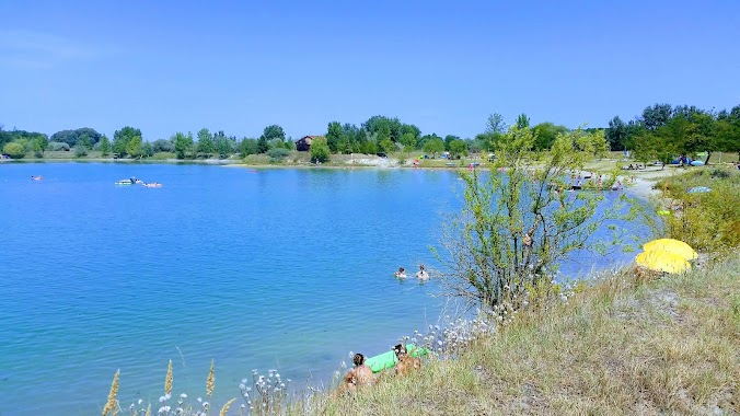
Feneketlen-tó
Szigetcsép, Feneketlen-tó, 2317 Hungary
contacts phone
:
+36
Latitude:
47.2747336
, Longitude:
18.9739337
larger map & directions
read more
nearest Natural feature
3.29 km
Csepel-sziget
Szigetcsép
Natural feature
read more
3.29 km
Csepel Island
Szigetcsép
Natural feature
read more
3.546 km
Damariba-sziget
Magyarország
Natural feature
read more
3.546 km
Damariba-sziget
Ungarn
Natural feature
read more
6.78 km
Bucka-tó
Szigetszentmiklós
Natural feature
read more
7.764 km
Ragád
Szigetszentmiklós
Natural feature
read more
8.114 km
Forrás Dunapart
Hungary
Natural feature
read more
8.114 km
Forrás Dunapart
Ungarn
Natural feature
read more
9.12 km
V. tó
Délegyháza
Natural feature
read more
9.375 km
Széchenyi
Magyarország
Natural feature
read more
11.532 km
Napsugár 2. Horgásztó
Kiskunlacháza
Natural feature
read more
11.535 km
Fővárosi Vízművek védőterülete
Hungría
Natural feature
read more
13.186 km
Újtelep
Ráckeve
Natural feature
read more
13.546 km
Czuczor-sziget
Hungary
Natural feature
read more
13.546 km
Czuczor-sziget
Węgry
Natural feature
read more
13.723 km
Kavicsos-tó
Hungría
Natural feature
read more
13.723 km
Kavicsos-tó
Węgry
Natural feature
read more
13.723 km
Kavicsos-tó
Hungary
Natural feature
read more
14.156 km
Kék-tó
Dunaharaszti
Natural feature
read more
14.408 km
Sóshegy
Szigetszentmiklós
Natural feature
read more
14.775 km
Szőlőhegy
Tárnok
Natural feature
read more
15.509 km
Tárnoki horgásztó
Tárnok
Natural feature
read more
16.806 km
Kavicsbánya-tó
Iváncsa
Natural feature
read more
17.715 km
Molnár-sziget
Budapest
Natural feature
read more
18.232 km
Sandor-halma
Bugyi
Natural feature
read more
📑
all categories
Accounting
Administrative area level 1
Administrative area level 2
Airport
Amusement park
Aquarium
Art gallery
Atm
Bakery
Bank
Bar
Beauty salon
Bicycle store
Book store
Bowling alley
Bus station
Cafe
Campground
Car dealer
Car rental
Car repair
Car wash
Casino
Cemetery
Church
City hall
Clothing store
Colloquial area
Convenience store
Country
Courthouse
Dentist
Department store
Doctor
Electrician
Electronics store
Embassy
Finance
Fire station
Florist
Food
Funeral home
Furniture store
Gas station
General contractor
Grocery or supermarket
Gym
Hair care
Hardware store
Health
Hindu Temple
Home goods store
Hospital
Insurance agency
Intersection
Jewelry store
Laundry
Lawyer
Library
Light rail station
Liquor store
Local government office
Locality
Locksmith
Lodging
Meal delivery
Meal takeaway
Mosque
Movie rental
Movie theater
Moving company
Museum
Natural feature
Neighborhood
Night club
Painter
Park
Parking
Pet store
Pharmacy
Physiotherapist
Place of worship
Plumber
Point of interest
Police
Political
Post office
Premise
Real estate agency
Restaurant
Roofing contractor
Route
Rv park, camping
School
Shoe store
Shopping mall
Spa
Stadium
Storage
Store
Subpremise
Subway station
Supermarket
Synagogue
Taxi stand
Train station
Transit station
Travel agency
University
Veterinary care
Zoo
administrative area level 3
sublocality level 1
↑