Lodging nearby Hotel Tiliana
Hungary
Lodging nearby Hotel Tiliana
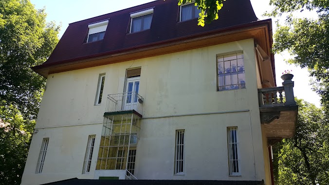
Hotel Tiliana
Budapest, Hárshegyi út 1 Magyarország
contacts phone
:
+36
Latitude:
47.5212402
, Longitude:
18.9733089
read more
nearest Lodging
Hotel Tiliana Hotel
Budapest, Hárshegyi út 1
Lodging
read more
33 m
Tiliana
Budapest, Hárshegyi út 1
Lodging
read more
988 m
Unique Panorama Apartment
Budapest, Dániel út 62
Lodging
read more
988 m
Wonderful Family Apartment
Dániel Út 62. 1/6
Lodging
read more
1.027 km
Beatrix Pension and Hotel
Budapest, Széher út 3
Lodging
read more
1.027 km
Beatrix Hotel
Budapest, Széher út 3
Lodging
read more
1.055 km
Buda Hill Apartment
Budapest, Hunyad lejtő 8
Lodging
read more
1.08 km
Congregatio Jesu Idős Nővérek Otthona
Budapest, Szarvas Gábor út 50
Lodging
read more
1.105 km
Viki Lak
Budapest, Zuhatag sor 9
Lodging
read more
1.131 km
Grand Hostel Budapest
Budapest, Hűvösvölgyi út 69
Lodging
read more
1.131 km
Grand Hostel Buda
Budapest, Hűvösvölgyi út 69
Lodging
read more
1.223 km
Buda Hills villa apartment
Budapest, Kútvölgyi út 99
Lodging
read more
1.253 km
IBS Garden Hotel
Budapest, Tárogató út 2
Lodging
read more
1.367 km
Hotel Bobbio Kft.
Budapest, Béla király út 47
Lodging
read more
1.589 km
Hotel Panda
Budapest, Pasaréti út 133
Lodging
read more
1.724 km
Hotel Vadvirág Panzió
Budapest, Nagybányai út 18
Lodging
read more
1.759 km
Buda Villa Panzió
Budapest, Kiss Áron utca 6.
Lodging
read more
1.774 km
Budai Sport Hotel
Budapest, Jánoshegyi út 105039
Lodging
read more
1.833 km
Schuminvest Kft.
Budapest, Szilágyi Erzsébet fasor 34
Lodging
read more
1.959 km
Private Szalonka Apartment
Budapest, Szalonka út 12
Lodging
read more
2.033 km
Svábi
Budapest, 1125, Felső Svábhegyi út 8b
Lodging
read more
2.274 km
Baboo Budapest Apartment
Budapest, 6 Gábor Áron utca 1. emelet
Lodging
read more
2.583 km
Villa Júlia
Budapest, Júlia utca 8
Lodging
read more
2.987 km
Buda Garden Apartment
Budapest, 16, Napsugár utca
Lodging
read more
3.068 km
Hotel Casa Latina
Budapest, Városmajor utca 88
Lodging
read more
📑
all categories
Accounting
Administrative area level 1
Administrative area level 2
Airport
Amusement park
Aquarium
Art gallery
Atm
Bakery
Bank
Bar
Beauty salon
Bicycle store
Book store
Bowling alley
Bus station
Cafe
Campground
Car dealer
Car rental
Car repair
Car wash
Casino
Cemetery
Church
City hall
Clothing store
Colloquial area
Convenience store
Country
Courthouse
Dentist
Department store
Doctor
Electrician
Electronics store
Embassy
Finance
Fire station
Florist
Food
Funeral home
Furniture store
Gas station
General contractor
Grocery or supermarket
Gym
Hair care
Hardware store
Health
Hindu Temple
Home goods store
Hospital
Insurance agency
Intersection
Jewelry store
Laundry
Lawyer
Library
Light rail station
Liquor store
Local government office
Locality
Locksmith
Lodging
Meal delivery
Meal takeaway
Mosque
Movie rental
Movie theater
Moving company
Museum
Natural feature
Neighborhood
Night club
Painter
Park
Parking
Pet store
Pharmacy
Physiotherapist
Place of worship
Plumber
Point of interest
Police
Political
Post office
Premise
Real estate agency
Restaurant
Roofing contractor
Route
Rv park, camping
School
Shoe store
Shopping mall
Spa
Stadium
Storage
Store
Subpremise
Subway station
Supermarket
Synagogue
Taxi stand
Train station
Transit station
Travel agency
University
Veterinary care
Zoo
administrative area level 3
sublocality level 1
↑