Gas station nearby OMV Benzinkút, Cece
Hungary
Gas station nearby OMV Benzinkút, Cece
OMV Benzinkút, Cece
Cece, Vasút utca 2 Hungary
contacts phone
:
+36
Latitude:
46.771188
, Longitude:
18.625549
read more
nearest Gas station
237 m
Magán - Cece
Cece, Vasútállomás
Gas station
read more
6.258 km
MOL Gas station
Simontornya, 61-es főút
Gas station
read more
10.137 km
MOL Benzinkút
Sárbogárd, Köztársaság út 147
Gas station
read more
14.071 km
OMV
Sárbogárd, Ady E. u. 3
Gas station
read more
20.409 km
Mobil Petrol
Paks
Gas station
read more
22.024 km
Shell
Dunaföldvár, Előszállási út
Gas station
read more
22.144 km
Petroltrade benzinkút
Lajoskomárom, 6402
Gas station
read more
22.162 km
MOL Benzinkút
Dunaföldvár, 6-os út
Gas station
read more
22.417 km
OMV
Dunaföldvár, Paksi út 125/a
Gas station
read more
22.616 km
Palotás Üzemanyagtöltő Kft.
Paks, Szabadság utca
Gas station
read more
22.616 km
Magán - Paks
Paks, Dunakömlőd, Szabadság u. 14. 8229/2 hrsz.
Gas station
read more
22.728 km
Lukoil Benzinkút
Dunaföldvár, Sas utca
Gas station
read more
24.444 km
ÖMV Benzinkút Gyozelem Kft
Lajoskomárom, 6404
Gas station
read more
24.69 km
MOL Benzinkút
Paks, 6.sz.fkl. út bal
Gas station
read more
26.8 km
Oil
Nagyvenyim, Fő utca 16
Gas station
read more
27.955 km
Magán - Kisapostag
Kisapostag, Főút 76 Km 6-Os
Gas station
read more
27.955 km
Duna Petrol
6-os fő út 76km
Gas station
read more
29.244 km
Super Mol Kft.
Dunaújváros, Papírgyári út 49
Gas station
read more
29.436 km
OMV
Dunaújváros, TS M6 autópálya 70 kmsz jobb
Gas station
read more
29.483 km
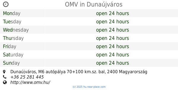
OMV
Dunaújváros, M6 autópálya 70+100 km.sz. bal
Gas station
read more
29.483 km
OMV töltőállomások
Dunaújváros, M6 autópálya 70+100 km.sz. bal
Gas station
read more
30.025 km
Envi
Dunaújváros, Kandó Kálmán tér 2
Gas station
read more
30.527 km
OMV Töltőállomás
Dunaújváros, Dózsa Gy. út
Gas station
read more
32.121 km
OMV
Dunaújváros, Aranyvölgyi út
Gas station
read more
32.182 km
Shell
Dunaújváros, Arany János utca 1
Gas station
read more
📑
all categories
Accounting
Administrative area level 1
Administrative area level 2
Airport
Amusement park
Aquarium
Art gallery
Atm
Bakery
Bank
Bar
Beauty salon
Bicycle store
Book store
Bowling alley
Bus station
Cafe
Campground
Car dealer
Car rental
Car repair
Car wash
Casino
Cemetery
Church
City hall
Clothing store
Colloquial area
Convenience store
Country
Courthouse
Dentist
Department store
Doctor
Electrician
Electronics store
Embassy
Finance
Fire station
Florist
Food
Funeral home
Furniture store
Gas station
General contractor
Grocery or supermarket
Gym
Hair care
Hardware store
Health
Hindu Temple
Home goods store
Hospital
Insurance agency
Intersection
Jewelry store
Laundry
Lawyer
Library
Light rail station
Liquor store
Local government office
Locality
Locksmith
Lodging
Meal delivery
Meal takeaway
Mosque
Movie rental
Movie theater
Moving company
Museum
Natural feature
Neighborhood
Night club
Painter
Park
Parking
Pet store
Pharmacy
Physiotherapist
Place of worship
Plumber
Point of interest
Police
Political
Post office
Premise
Real estate agency
Restaurant
Roofing contractor
Route
Rv park, camping
School
Shoe store
Shopping mall
Spa
Stadium
Storage
Store
Subpremise
Subway station
Supermarket
Synagogue
Taxi stand
Train station
Transit station
Travel agency
University
Veterinary care
Zoo
administrative area level 3
sublocality level 1
↑