HungaryCegled
Cegled
Administrative Region:
Pest
population:
35 545
calling code:
+36-53
postcode:
2700
Location on the map of Hungary
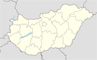
Cegled
Moving company


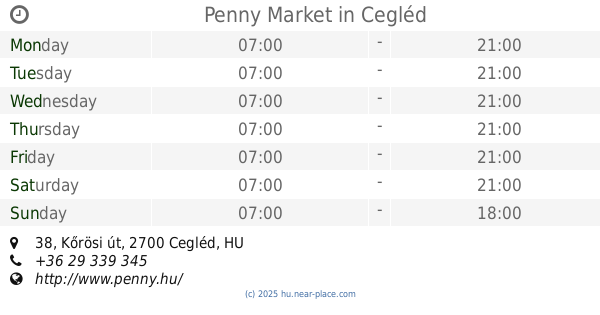
Supermarket


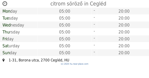
Restaurant


Art gallery
Local government office
Molnár Mária Református Fogyatékos Ápoló-Gondozó Otthon
Cegléd, Bercsényi utca 5
📑 Cegled all categories
AccountingAdministrative area level 2AirportArt galleryAtmBakeryBankBarBeauty salonBicycle storeBook storeBus stationCafeCampgroundCar dealerCar rentalCar repairCar washCemeteryChurchCity hallClothing storeConvenience storeCourthouseDentistDepartment storeDoctorElectricianElectronics storeFinanceFire stationFloristFoodFuneral homeFurniture storeGas stationGeneral contractorGrocery or supermarketGymHair careHardware storeHealthHome goods storeHospitalInsurance agencyJewelry storeLaundryLawyerLibraryLiquor storeLocal government officeLocalityLodgingMeal takeawayMovie theaterMoving companyMuseumNatural featureNeighborhoodNight clubPainterParkParkingPharmacyPlace of worshipPlumberPoint of interestPolicePost officePremiseReal estate agencyRestaurantRouteSchoolShoe storeShopping mallSpaStorageStoreSupermarketTrain stationTravel agencyUniversityVeterinary caresublocality level 1