Cafe nearby Sün Kávézó
Hungary
Cafe nearby Sün Kávézó
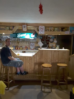
Sün Kávézó
2, Móra Ferenc utca, 2339, Majosháza, HU Hungary
contacts phone
:
+36 20 800 5855
Latitude:
47.2667638
, Longitude:
18.995494
larger map & directions
read more
nearest Cafe
1.968 km
Nemzeti Dohánybolt
Szigetcsép, Fő utca 39-41
Cafe
read more
4.919 km
verakave.hu
Délegyháza, Majosi út 21
Cafe
read more
8.124 km
National tobacco shop
Százhalombatta, Olimpia utca 1
Cafe
read more
8.124 km
Nemzeti Dohánybolt
Százhalombatta, Olimpia utca 1
Cafe
read more
8.555 km
Rétesbolt és Cukrászda
Szigetszentmiklós, Bajcsy-Zsilinszky utca 24
Cafe
read more
8.643 km
Edu-Show
Szigetszentmiklós, Szent Miklós útja 16
Cafe
read more
8.823 km
Black Cat
Százhalombatta, Erkel Ferenc körút 7
Cafe
read more
9.048 km
Csúcs Pont Caffe
Százhalombatta, Berzsenyi Dániel utca 1
Cafe
read more
9.066 km
Cukorfalat Cukrászda és Kávéház
Szigetszentmiklós, Tököli út 60
Cafe
read more
9.202 km
Csengeri Cukrászda
Taksony, Fő út 47
Cafe
read more
9.39 km
Bowling Cafe
Szigetszentmiklós, Bajcsy-Zsilinszky utca 1/a
Cafe
read more
9.436 km
Dzsúzda
Szigetszentmiklós, Tököli út 26
Cafe
read more
10.509 km
Csajos Büfé
Dunaharaszti, Unnamed Road, 2330
Cafe
read more
11.299 km
Sutyi & Sasi Pizzéria
Ráckeve, Kastély utca 2
Cafe
read more
12.106 km
Lipóti pékség
Dunaharaszti, Dózsa György út 51
Cafe
read more
12.106 km
Lipóti bakery
Dunaharaszti, Dózsa György út 51
Cafe
read more
12.114 km
Baktay Kávézó
Dunaharaszti, Baktay Ervin tér 5
Cafe
read more
12.346 km
Timi Presszó
Dunaharaszti, Fő út 98
Cafe
read more
12.369 km
Haraszti Caffe Kft. /Haraszti Café/
Dunaharaszti, Fő út 92
Cafe
read more
12.508 km
Centrum fagyizó
Ráckeve, Kossuth Lajos utca 3
Cafe
read more
12.509 km
Gergely Traccs Cuki
Dunaharaszti, Petőfi Sándor utca 15
Cafe
read more
13.504 km
bar coffee
Érd, Budai út 24
Cafe
read more
13.71 km
Duraku Pékség
Érd, Velencei út 20
Cafe
read more
14.519 km
Cafe + Co Kft.
Alsónémedi, Ócsai út 7
Cafe
read more
14.619 km
Pataki Cukrászda 1973
Érd, Balatoni út 61
Cafe
read more
📑
all categories
Accounting
Administrative area level 1
Administrative area level 2
Airport
Amusement park
Aquarium
Art gallery
Atm
Bakery
Bank
Bar
Beauty salon
Bicycle store
Book store
Bowling alley
Bus station
Cafe
Campground
Car dealer
Car rental
Car repair
Car wash
Casino
Cemetery
Church
City hall
Clothing store
Colloquial area
Convenience store
Country
Courthouse
Dentist
Department store
Doctor
Electrician
Electronics store
Embassy
Finance
Fire station
Florist
Food
Funeral home
Furniture store
Gas station
General contractor
Grocery or supermarket
Gym
Hair care
Hardware store
Health
Hindu Temple
Home goods store
Hospital
Insurance agency
Intersection
Jewelry store
Laundry
Lawyer
Library
Light rail station
Liquor store
Local government office
Locality
Locksmith
Lodging
Meal delivery
Meal takeaway
Mosque
Movie rental
Movie theater
Moving company
Museum
Natural feature
Neighborhood
Night club
Painter
Park
Parking
Pet store
Pharmacy
Physiotherapist
Place of worship
Plumber
Point of interest
Police
Political
Post office
Premise
Real estate agency
Restaurant
Roofing contractor
Route
Rv park, camping
School
Shoe store
Shopping mall
Spa
Stadium
Storage
Store
Subpremise
Subway station
Supermarket
Synagogue
Taxi stand
Train station
Transit station
Travel agency
University
Veterinary care
Zoo
administrative area level 3
sublocality level 1
↑