Cafe nearby Panoramia Cafe & Bar
Coronavirus disease (COVID-19) Situation
confirmed cases
2230232
deaths
49048
Hungary
Cafe nearby Panoramia Cafe & Bar
Panoramia Cafe & Bar
31, Hunyadi János út, 1011, Budapest, HU Ungarn
contacts phone
:
+36
Latitude:
47.5018351
, Longitude:
19.0353517
larger map & directions
read more
nearest Cafe
180 m
Buda Rétesvár-strudel
Budapest, Balta köz 4
Cafe
read more
197 m
Bloom Coffee
Budapest, Szalag utca 30
Cafe
read more
324 m
art'bistrobar
Budapest, Bem rakpart 16
Cafe
read more
449 m
Isolabella Café
Budapest, Iskola utca 36
Cafe
read more
478 m
Lánchíd Söröző
Budapest, Fő utca 4
Cafe
read more
519 m
Sis & Bro Boutique Café
Budapest, Pauler utca 11
Cafe
read more
601 m
세체니 다리_들술 벤치
Budapest, Lánchíd utca 5
Cafe
read more
649 m
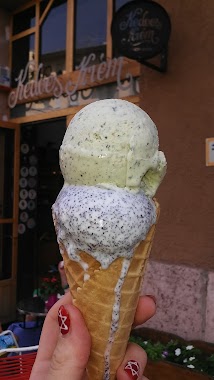
Kedves Krém
Budapest, Batthyány utca 26
Cafe
read more
680 m
Macskakő Kvqp
Budapest, Fiáth János utca 8
Cafe
read more
726 m
Rásza Caffé & Gallery
Budapest, Mészáros utca 4
Cafe
read more
881 m
MÓKA Kávézó (Módszertani Kabinet)
Budapest, 1027, Varsányi Irén utca 9
Cafe
read more
892 m
Budai Ketto (Buda’s Two)
Budapest, Jurányi utca 5
Cafe
read more
929 m
Starbucks Széna tér
Budapest, Széna tér
Cafe
read more
947 m
Garibaldi Bistro
Budapest, Garibaldi utca 4
Cafe
read more
965 m
Starbucks Széna
Budapest, Margit körút 91
Cafe
read more
965 m
Starbucks
Budapest, Margit körút 91
Cafe
read more
1.002 km
Little Irish cafe
Budapest, Nádor utca 34
Cafe
read more
1.011 km
Cafe Frei Mammut
Budapest, Lövőház utca 2
Cafe
read more
1.041 km
Spoon
Budapest, Vigadó tér 3. kikötő
Cafe
read more
1.091 km
Szerelmes Levél (Pékműhely)
Budapest, Lövőház utca 7-9
Cafe
read more
1.153 km
Auguszt
Budapest, Fény utca 8
Cafe
read more
1.185 km
Szalonspicc Kávé és Borbár
Budapest, Lövőház utca 17
Cafe
read more
1.257 km
Mr. Gofri Sütödéje
Budapest, Lövőház utca 22
Cafe
read more
1.311 km
Ecocafe Magnet
Budapest, Balassi Bálint utca 9
Cafe
read more
1.336 km
Arabica Café Shop
Budapest, Lövőház utca 26
Cafe
read more
📑
all categories
Accounting
Administrative area level 1
Administrative area level 2
Airport
Amusement park
Aquarium
Art gallery
Atm
Bakery
Bank
Bar
Beauty salon
Bicycle store
Book store
Bowling alley
Bus station
Cafe
Campground
Car dealer
Car rental
Car repair
Car wash
Casino
Cemetery
Church
City hall
Clothing store
Colloquial area
Convenience store
Country
Courthouse
Dentist
Department store
Doctor
Electrician
Electronics store
Embassy
Finance
Fire station
Florist
Food
Funeral home
Furniture store
Gas station
General contractor
Grocery or supermarket
Gym
Hair care
Hardware store
Health
Hindu Temple
Home goods store
Hospital
Insurance agency
Intersection
Jewelry store
Laundry
Lawyer
Library
Light rail station
Liquor store
Local government office
Locality
Locksmith
Lodging
Meal delivery
Meal takeaway
Mosque
Movie rental
Movie theater
Moving company
Museum
Natural feature
Neighborhood
Night club
Painter
Park
Parking
Pet store
Pharmacy
Physiotherapist
Place of worship
Plumber
Point of interest
Police
Political
Post office
Premise
Real estate agency
Restaurant
Roofing contractor
Route
Rv park, camping
School
Shoe store
Shopping mall
Spa
Stadium
Storage
Store
Subpremise
Subway station
Supermarket
Synagogue
Taxi stand
Train station
Transit station
Travel agency
University
Veterinary care
Zoo
administrative area level 3
sublocality level 1
↑