Atm nearby OTP ATM
Hungary
Atm nearby OTP ATM
OTP ATM
2a, Vajdahunyad utca, 1082, Budapest, HU Węgry
contacts phone
:
+36
website:
otpbank.hu
Latitude:
47.4896231
, Longitude:
19.0731155
larger map & directions
read more
nearest Atm
192 m
Otpbank ATM
Budapest, József körút 53
Atm
read more
202 m
OTP ATM
Budapest, Baross utca 56
Atm
read more
309 m
Bankomat
Budapest, József körút 69
Atm
read more
332 m
CIB Bank ATM
Budapest, József körút 34
Atm
read more
352 m
Euronet Bankautomata
Budapest, József körút 75
Atm
read more
395 m
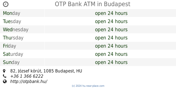
OTP Bank ATM
Budapest, József körút 82
Atm
read more
406 m
Otp ATM Corvin
Budapest, Unnamed Road
Atm
read more
408 m
Erste Bank ATM
Budapest, József körút 30
Atm
read more
468 m
Raffeisen Bank ATM
Budapest, Üllői út 36
Atm
read more
632 m
Euronet ATM
Budapest, Ferenc körút 36
Atm
read more
777 m
Euronet ATM
Budapest, Ráday utca 16
Atm
read more
802 m
Erste Bank
Budapest, Baross utca 1
Atm
read more
862 m
OTP ATM
Budapest, Ráday utca 48
Atm
read more
869 m
Raiffeisen ATM
Budapest, Rákóczi út 44
Atm
read more
880 m
CIB Bank ATM
Budapest, Erzsébet körút 2
Atm
read more
886 m
Otp ATM
Budapest, Teleki László tér
Atm
read more
890 m
CIB Bank ATM
Budapest, Ferenc körút 15
Atm
read more
893 m
Euronet ATM
Budapest, Múzeum körút 31
Atm
read more
903 m
Euronet ATM
Budapest, Rákóczi út 26
Atm
read more
930 m
CIB Bank ATM
Budapest, Kálvin tér 4
Atm
read more
965 m
Euronet Atm
Budapest, Lónyay utca 31
Atm
read more
971 m
Euronet ATM
Budapest, Dohány utca 56
Atm
read more
1.059 km
Euronet ATM
Budapest, Rákóczi út 1
Atm
read more
1.096 km
OTP Bankautomata
Budapest, Fiumei út 11
Atm
read more
1.154 km
ATM OTP
Budapest, Wesselényi utca
Atm
read more
📑
all categories
Accounting
Administrative area level 1
Administrative area level 2
Airport
Amusement park
Aquarium
Art gallery
Atm
Bakery
Bank
Bar
Beauty salon
Bicycle store
Book store
Bowling alley
Bus station
Cafe
Campground
Car dealer
Car rental
Car repair
Car wash
Casino
Cemetery
Church
City hall
Clothing store
Colloquial area
Convenience store
Country
Courthouse
Dentist
Department store
Doctor
Electrician
Electronics store
Embassy
Finance
Fire station
Florist
Food
Funeral home
Furniture store
Gas station
General contractor
Grocery or supermarket
Gym
Hair care
Hardware store
Health
Hindu Temple
Home goods store
Hospital
Insurance agency
Intersection
Jewelry store
Laundry
Lawyer
Library
Light rail station
Liquor store
Local government office
Locality
Locksmith
Lodging
Meal delivery
Meal takeaway
Mosque
Movie rental
Movie theater
Moving company
Museum
Natural feature
Neighborhood
Night club
Painter
Park
Parking
Pet store
Pharmacy
Physiotherapist
Place of worship
Plumber
Point of interest
Police
Political
Post office
Premise
Real estate agency
Restaurant
Roofing contractor
Route
Rv park, camping
School
Shoe store
Shopping mall
Spa
Stadium
Storage
Store
Subpremise
Subway station
Supermarket
Synagogue
Taxi stand
Train station
Transit station
Travel agency
University
Veterinary care
Zoo
administrative area level 3
sublocality level 1
↑